Import elevation data derived from Robinson et al. (2014). If data are not available locally, they are downloaded from a Zenodo repository (doi:10.5281/zenodo.5719984 ).
Usage
get_global_elevation_data(
  dir = tempdir(),
  version = "latest",
  force = FALSE,
  verbose = TRUE
)
Arguments
- dir
characterFolder path for downloading and caching data. By default, data are downloaded to a temporary directory (i.e.,tempdir()). To avoid downloading the same data multiple times, it is strongly recommended to specify a persistent storage location (see Examples below).- version
characterValue indicating the specific version of the dataset that should be downloaded. The version should be indicated using the Digital Object Identifier of the specific version required (e.g."10.5281/zenodo.3673586"). Defaults to"latest"such that the latest release of the dataset with available habitat data is used.- force
logicalShould the data be downloaded even if the the data are already available? Defaults toFALSE.- verbose
logicalShould progress be displayed while downloading data? Defaults toTRUE.
Value
A terra::rast() object containing the elevation data
(100 m resolution). Pixel values indicate elevation (m).
Details
The data were produced by (i) obtaining raw elevation data from EarthEnv project, (ii) collating the data into a single raster (GeoTIFF) file, and then (iii) reprojecting the data to the World Behrmannn coordinate reference systems (ESRI:54017). For further details, see the online repository containing code used to process the data.
References
Robinson N, Regetz J, and Guralnick RP (2014) EarthEnv-DEM90: A nearly- global, void-free, multi-scale smoothed, 90m digital elevation model from fused ASTER and SRTM data. ISPRS Journal of Photogrammetry and Remote Sensing, 87:57–67. doi:10.1016/j.isprsjprs.2013.11.002
Examples
# \dontrun{
# define persistent storage location
download_dir <- rappdirs::user_data_dir("aoh")
# create download directory if needed
if (!file.exists(download_dir)) {
dir.create(download_dir, showWarnings = FALSE, recursive = TRUE)
}
# download and import elevation data
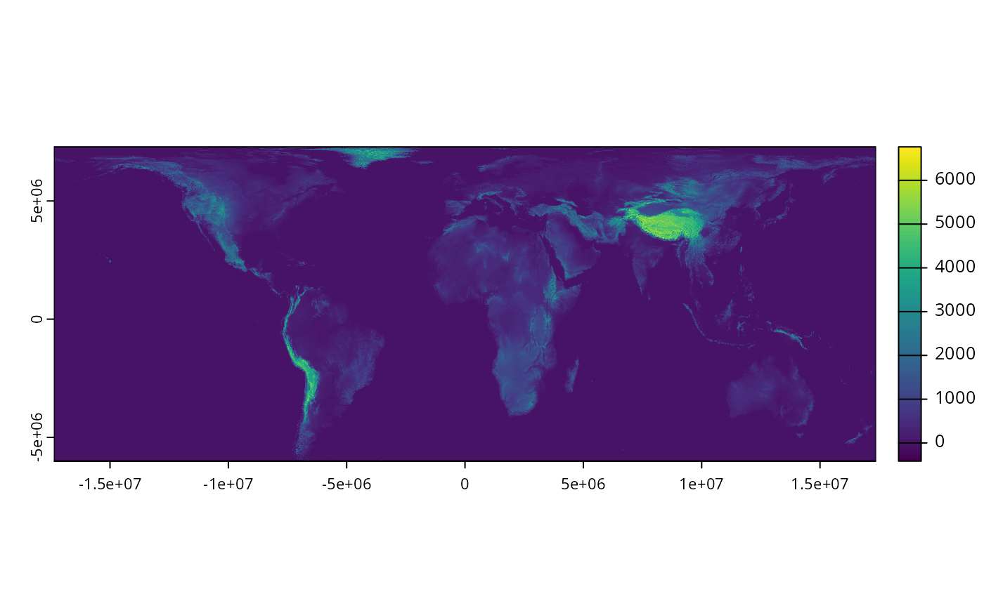
elev_data <- get_global_elevation_data(download_dir)
# preview data
print(elev_data)
#> class : SpatRaster
#> size : 132926, 347351, 1 (nrow, ncol, nlyr)
#> resolution : 100, 100 (x, y)
#> extent : -17367531, 17367569, -6005523, 7287077 (xmin, xmax, ymin, ymax)
#> coord. ref. : World_Behrmann
#> source : dem-100m-esri54017.tif
#> name : dem-100m-esri54017
# plot data
plot(elev_data)
 # }
# }